

Research Article
Abstract
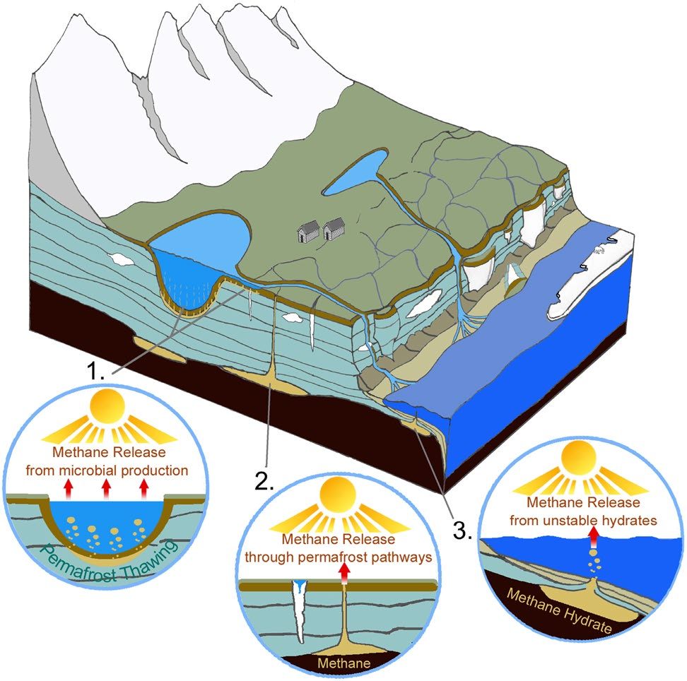
Arctic permafrost stores vast amounts of methane (CH4) in subsurface reservoirs. Thawing permafrost creates areas for this potent greenhouse gas to be released to the atmosphere. Identifying ‘hot spots’ of methane flux on a local scale has been limited by the spatial scales of traditional ground-based or satellite-based methane-sampling methods. Here we present a reliable and an easily replicable design using only off-the-shelf, cost-effective methane sensor components and an Unmanned Aerial System (UAS).
Our results demonstrate the high efficiency of the design and the advantages of this methodology for environmental methane studies that are subjected to the high spatial variability of methane levels. On Barter Island, NE Alaska, we noted spikes in CH4 concentrations coincident with topographic features or anomalies. Such spikes may be attributed to enhanced land/air transfer and may reveal zones of high methane production and/or minimal oxidation in areas of thermoerosional gullies along thawing coastal zones.
Thermoerosional gullies represent hotspots that release significantly higher levels of methane than the surrounding areas, thus suggesting that point sampling is inadequate in characterizing methane releases and that increasing rates of permafrost thaw may result in increasing point sources of high CH4 emissions.
Read the article
